Boulder Ranger District Pile Burning Update – January 2022
Firefighters plan to continue pile burning efforts next week in the following locations on the Boulder Ranger District as conditions allow:
• Lump Gulch 18: 1,500 hand piles; General Location: Gilpin County a half-mile north of Rollinsville on Westside of Hwy 119 Peak to Peak
• James Creek Unit M1701: 8,000 hand piles; General Location: East of Hwy 72 near Peaceful Valley
• Lump Gulch 29, 30: 150 hand piles; General Location: Gilpin County west side of Lump Gulch Road, 1.5 miles south of Rollinsville on west side of Highway 119
• Lump Gulch 35: 150 machine piles; General Location: Gilpin County south side of Gilpin Road, 3 miles south of Rollinsville on west side of Highway 119
• James Creek RFB Units 6, 8: 5,000 hand piles; General location: Half mile south of Jamestown or quarter mile east of Bar K Ranch
• James Creek Unit RFB Unit 10: 1,500 hand piles; General location: 2 miles east of Peak to Peak Highway on CR52
• St Vrain 12A, 12B, 12d: 50 piles; General Location: In the town of Meeker Park
About Pile Burning
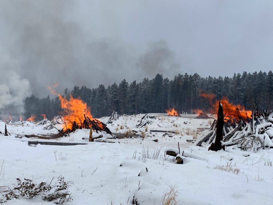
Pile burning is one tool forest managers use to reduce the buildup of fuels on the landscape under the safest conditions. Wind helps disperse smoke created during pile burning operations and snow helps keep the piles contained. Seeing flames and smoke, even after dark, is part of normal operations. Conditions are evaluated each day to determine if ignition will take place. Ignitions are generally expected to begin after 10 a.m. and will cease several hours before sunset. Smoke may be visible. Precipitation, wind, temperature, fuel moisture, and staffing all play a part in when and whether ignition occurs. Firefighters monitor the area after burning is complete. Public and firefighter safety is always the number-one priority in burning operations.
Prescribed fire smoke may affect your health. More information about smoke impacts is available at https://www.colorado.gov/