
Resources for Partners
Geospatial Tools
The Northern Colorado Fireshed Collaborative has developed two geospatial tools for partner use. These tools can be used to collaboratively develop informed projects, track targets across cohesive strategy, form stronger grant proposals connected to shared goals, report progress, inform storytelling, and can be a useful tool for the investment committee project selection.
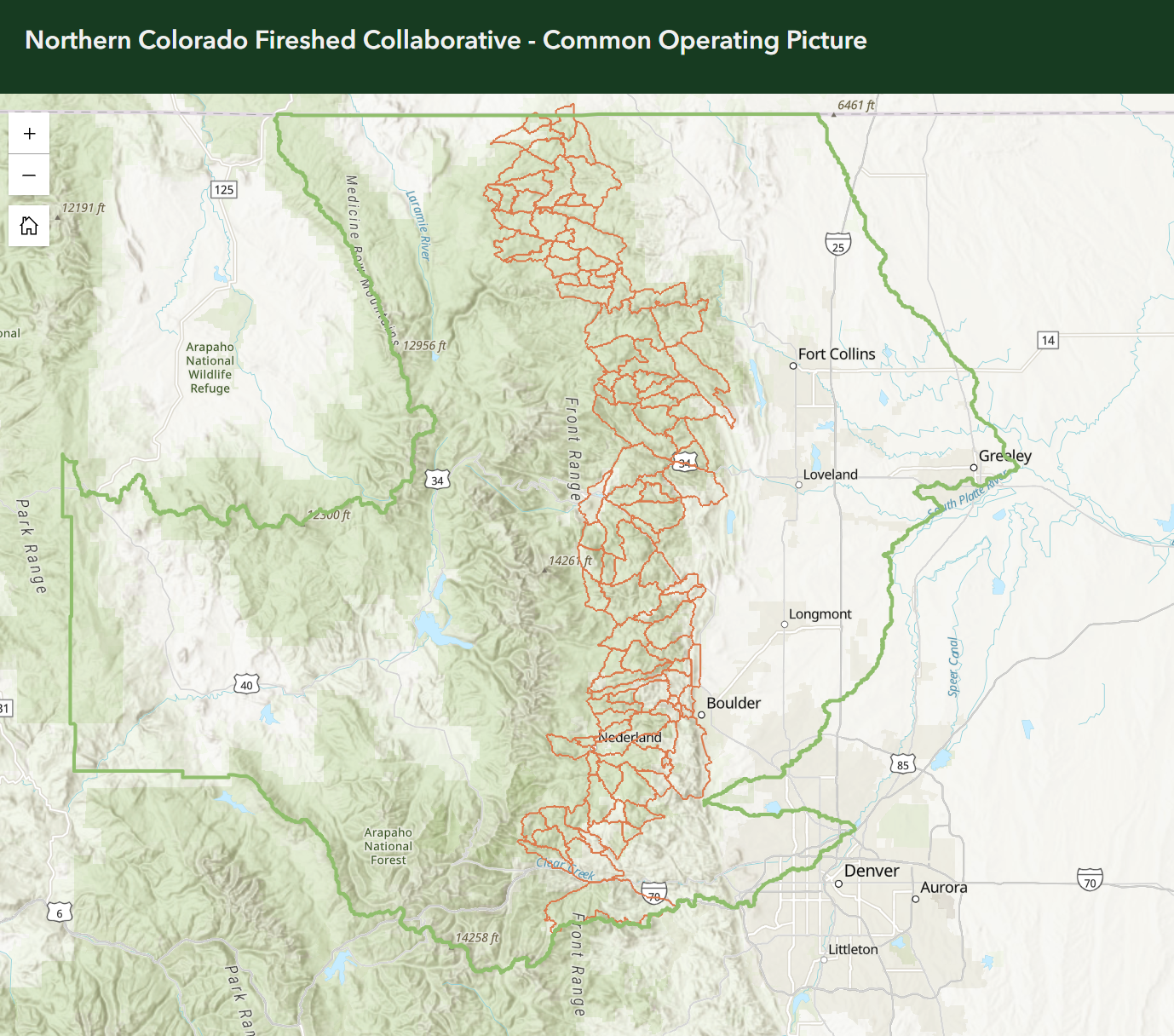
Common Operating Picture
Goal: Live tracking of the Fireshed’s forestry project progress for better utilization of resources, visibility of organizational presence in communities, and future project planning. Requires login to ARC Online, must be added by CSFS. Email Izzy to be added (izzy.sofio@emberalliance.org.) You can also contact Izzy for a temporary login if your organization does not have ArcOnline access. Please add your fuel treatment projects – this will replace the need to submit project to CSFS every year, but will instead be a one-stop-shop for NCFC members. For a refresher on how to use, click here.
PODs Dashboard
For partners to plan projects under a shared vision at scale. The tool ties PODs to the National Cohesive Wildland Fire Management Strategy to better visualize, track, collaboratively plan, and align actions across the entire fireshed. PODs are a way to break up the landscape into manageable pieces for treatment, strengthening boundaries, and implementing Rx fire.
No login required. This tool will eventually incorporate treatment data from the COP, but currently is meant as a planning tool.
Collaborative Capacity Resources
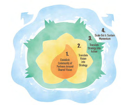
Collaborative Stages of Readiness
The Stages of Collaborative Readiness framework, produced by the Colorado Forest Restoration Institute (CFRI), is a resource that helps partners understand where they are in building the relationships, capacity, planning, and coordination needed to advance wildfire resilience.
How to use: Partners can use this framework to identify their current stage, recognize opportunities for growth, and determine the next steps needed to move toward greater readiness and on-the-ground impact. Partners can also use this framework to inform Fireshed Fund grant proposals, connecting funding requests to specific capacity needs and readiness goals.
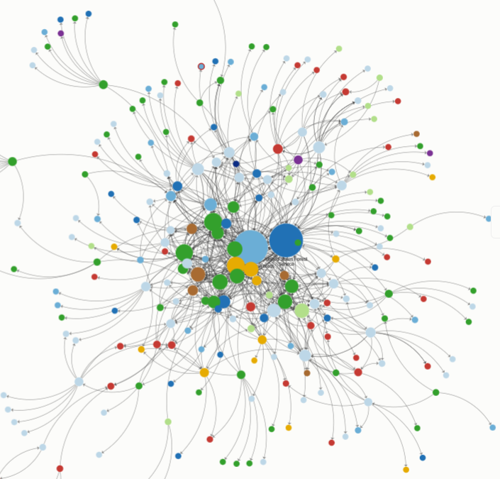
Colorado Front Range FireCollabMap
FireCollabMap is a collection of interactive maps, networks, and directories that allow users to explore where and what groups work on wildfire adaptation and land stewardship on the Colorado Front Range as well as how these groups work together.
No one organization alone can effectively reduce wildfire risk, a challenging threat that spans public and private lands and impacts a wide array of actors and communities. The Fueling Adaptation research team conducted an online survey of groups involved in wildfire risk management, land stewardship, and/or community development on the Colorado Front Range in fall 2024.
How to use: Use this interactive tools to explore partner connections, find organizations working across the landscape, and better understand wildfire risk and collaborative capacity in Colorado’s Front Range.
Partner Communication
Subscribe to the Internal NCFC Newsletter
The NCFC sends out a monthly newsletter with partner updates, funding opportunities, shared communication resources, and more. Staff at partner organizations are welcome to subscribe! Send an email to bridgette.windell@emberalliance.org to sign up.